Mapping Prejudice
Visualizing the hidden histories of race and privilege in the built environment

Join Our Team
We are looking for a new colleague with knowledge of BIPOC communities to lead our community engagement work. Our new Associate Director will help us develop our strategies for community co-creation and shape the future of Mapping Prejudice.
Learn More
Hennepin County Covenants
Download shapefiles, spreadsheets and static cartography related to Hennepin County racial covenants. We work with community members to make datasets and maps for open access.
Learn More
Ramsey County Data: Stay Tuned
Thanks to everyone who transcribed property records from Ramsey County. Data cleaning is underway and an in-progress map of Ramsey racial covenants will be released later this spring.
Learn More
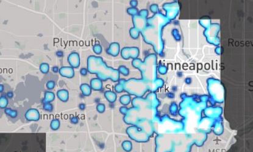
This interactive visualization shows the spread of racially-restrictive deeds across Hennepin County during the first half of the twentieth century.
Click on a racially covenanted lot to learn more about the property. Use the search button at the bottom of the map to look for a specific address.
** If you are having issues with any of the features on our map, try clearing your browser's cache and reloading the window **
Racial covenants were tools used by real estate developers to prevent people of color from buying or occupying property. Often just a few lines of text, these covenants were inserted into warranty deeds across the country. These real estate contracts were powerful tools for segregationists. Real estate developers and public officials used private property transactions to build a hidden system of American apartheid during the twentieth century.
Inspired by the idea that we cannot address the inequities of the present without an understanding of the past, Mapping Prejudice was created to expose the racist practices that reshaped the landscape of Minneapolis. People of color see how discriminatory practices cascade through their lives, erecting barriers that limit access to housing, credit, education, and wealth. But the resulting physical, emotional, and financial baggage has been harder to recognize for people who have not personally experienced racism. Mapping Prejudice seeks to make these burdens visible by locating them on a digital, interactive map. The project team was inspired by a desire to create the first-ever comprehensive map of racial covenants for an American community.
The project started in Minneapolis, where research revealed that the city was not always segregated. Covenants helped remake the racial landscape of the city. As racially-restrictive deeds spread, African Americans were pushed into small and increasingly circumscribed neighborhoods. Even as the number of black residents continued to climb, ever-larger swaths of the city became entirely white.
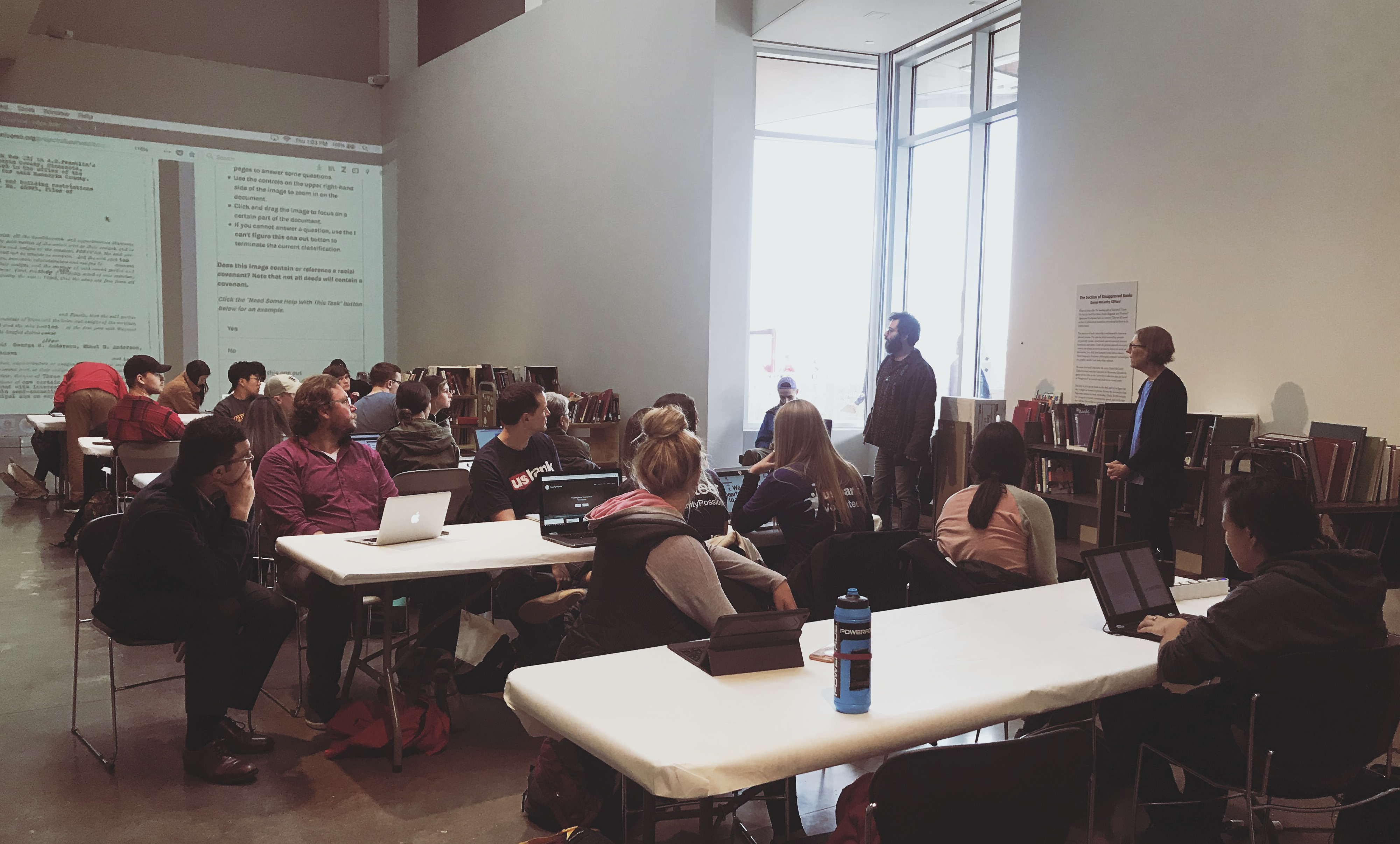
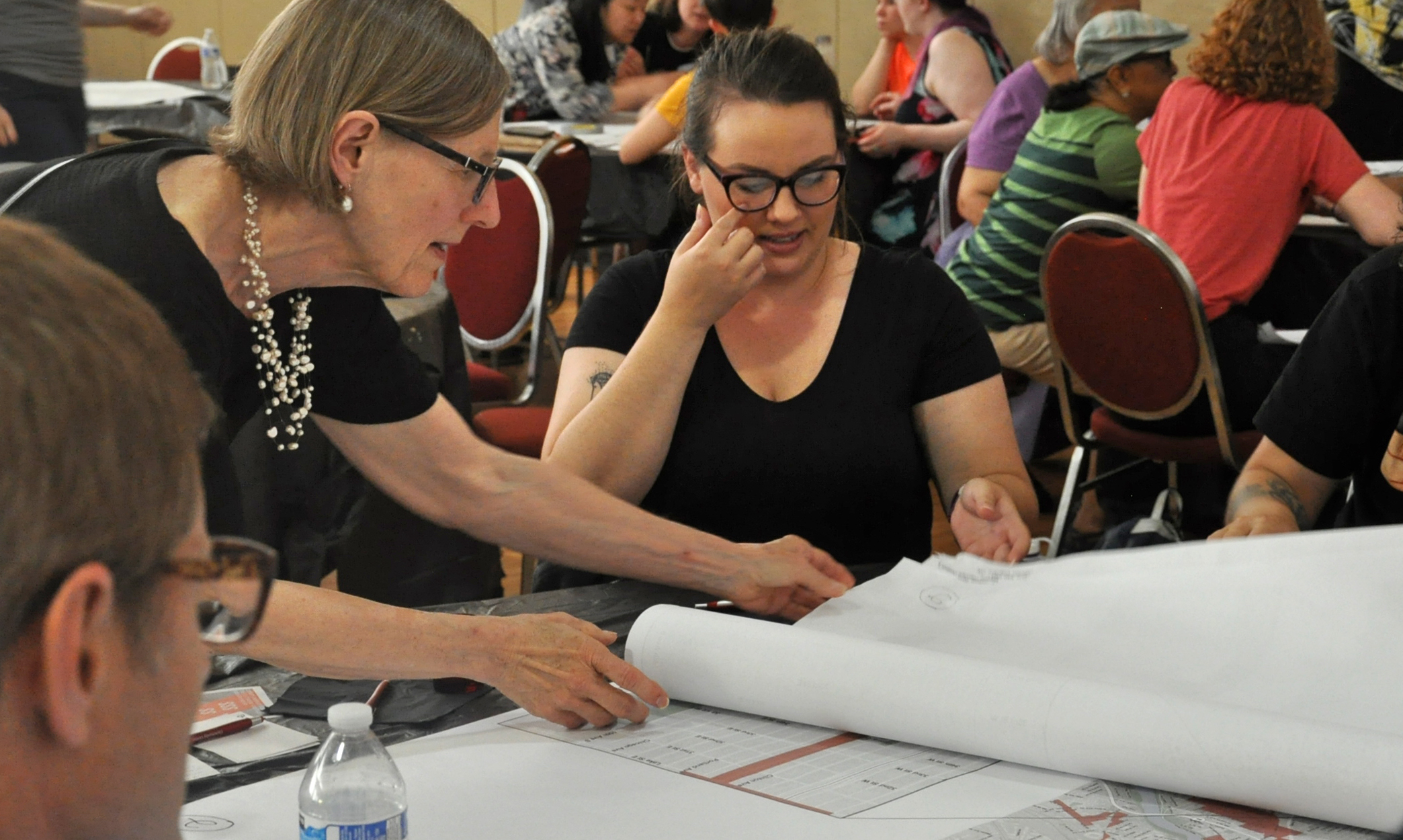
The project is based at the John Borchert Map Library at the University of Minnesota. From this base, our interdisciplinary team of community activists, students and scholars has mobilized community members to identify discriminatory deeds. Thanks to the enthusiastic support of the community, the Hennepin County map was finished early in 2020.
